US Bureau of Reclamation, Pacific Northwest Region
Bear Creek and Little Butte Creek Basins
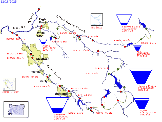 PROVISIONAL DATA – SUBJECT TO CHANGE!
Average daily streamflows indicated in cubic feet per second.
Reservoir levels current as of midnight on date indicated.
Click on gaging stations (red dots) for streamflow hydrographs.