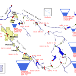
MEDFORD, Ore– Recently, Oregon Wildfire Response released a new detailed hiking map to the public. The map was created to help people better understand where hiking closures are, because of last year’s wildfires, to help the public plan ahead, avoid closed areas, and recreate safely outdoors.
Oregon currently has a large number of post-fire recreation area closures across many land management agencies because of the 2020 wildfire season. According to Oregon Wildfire Response, there was a need for a ‘one-stop-shop’ map for the public to be able to understand where these closures are. The agency says that by creating this map, this allows the public to plan ahead and be prepared prior to arriving at their hiking destination.
According to Oregon Wildfire Response, the map is not updated in real-time which means that there could be delays on when a hiking trail opens back up.
During last year’s wildfire season, more than a million acres of land was destroyed and more than 3,000 buildings were completely eradicated.
If you would like to take a look the interactive map you can click the link below.
https://wildfire.oregon.gov/Pages/Recreation-Impacts.aspxhttps://wildfire.oregon.gov/Pages/Recreation-Impacts.aspx


